
Horizon RiskReview™
Aerial Infrastructure Inspection & Thermal Hazard Detection

Drone Powered
Infrastructure & Property Assessments
Insurance-grade property & infrastructure assessments
Leverage centimeter-level RTK positioning, ultra-high-resolution orthomosaics, and thermal moisture mapping to uncover hidden defects, quantify storm impacts, and generate detailed, decision-ready reports. Trusted by homebuyers, insurers, and critical infrastructure teams managing water lines, electrical grids, and high-value sites—reach out today to protect your investment.
Why It Matters...
See Your Property Like Never Before...
Whether you’re buying, filing an insurance claim, or planning repairs, our drone-powered property assessments deliver the clarity you need. In a single flight we capture high-resolution aerial imagery, 3D terrain models, and thermal scans—pinpointing roof leaks, foundation settlement, drainage issues, and storm damage before they become costly surprises.
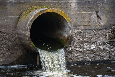
The same tools scale up for critical infrastructure—from water lines, impoundments, and ROW corridors to substations and large electrical sites. We help engineers spot wet spots, erosion, and grading issues early, so maintenance teams can act before small problems become major outages or environmental events.

Find The Right Solution
Select Your Package Level

Home Buyer
Identify issues before you buy.

Insurance
Accurate document claims.

Pre-Repair
Pinpoint exact defects.
Critical Infrastructure & Utilities
Safeguard water lines, corridors, and grids.
Horizon RiskReview™ Packages
This is for homeowners, business owners, and property managers needing detailed roof and structural assessments for maintenance, insurance documentation, or post-storm damage evidence.
Photos Only
Request a Free Quote
-
Aerial RGB photos
-
Annotated callouts highlighting visible damage or areas of concern
Evidence Pack
Request a Free Quote
-
Organized claim-ready photo set
-
Time-stamped and geotagged evidence
-
Heavier annotation and structured report format
Thermal + Summary
Request a Free Quote
-
RGB photos and thermal images
-
Annotated callouts on key RGB and thermal images
-
Short summary report
Site & Stormwater
Request a Free Quote
-
Full site and stormwater documentation
RTK Orthophoto Baseline
Request a Free Quote
-
Measurable property and site baseline
-
RGB and/or thermal where appropriate
Asset Review
Request a Free Quote
-
Professional asset review depending on scope
Complex Asset Review
Request a Free Quote
-
Complex asset review depending on access, risk, and reporting needs
Optional Rush Addition
24-hour Rush Option available for expedited delivery.
How It Works
See Clearly. Plan Confidently. Protect What Matters.

Plan
“Define your assessment needs—whether you’re buying, filing an insurance claim, or planning repairs—so we capture the right data.”

Fly
“Conduct a precise aerial survey of roofs, foundations, yards, and drainage with our FAA-certified remote pilot."

Expert Team
“Process imagery into orthomosaics, 3D elevation models, and thermal scans to spot leaks, settlement, and grading issues.”

Deliver
“Package your results into clear maps, 3D views, and annotated images that your team, insurer, or engineers can open and use right away.”

Get your results
“Walk through the findings with our experts, get tailored recommendations, and plan your next steps with confidence.”
Explore Our Other Services
Beyond the blueprint -- Discover services that elevate your land.


